|
Reference/Instructional Materials
Warning, Watch and Advisory Criteria Guide on warnings, watches, advisories, for storms, winter weather, fog, and other weather phenomena
METAR HTML guide on how to decode METAR observations
FOUS/MOS. HTML guide on how to decode MOS text data.
FOUS/OUTPUT. HTML guide on how to decode numerical output data.
TAMU Wx Interface Practice your decoding skills!
Station Models Guide
Satellite Tutorial Satellite examples and instruction
Forecasting Snowfall Presentation
Help Menu Pages COD Help and Tutorial Pages for COD products and forecasting
Modules and Exercises COD page of examples, projects, and exercies/quizes
CSI Homepage Conditional Symmetric Instability Page, including a winter time case study
Severe Page Help withe Severe Text
Frequently Used Contractions from the National Weather Service (help with "weatherese").
SPC Acronyms Page (Link to SPC's web page of acronyms)
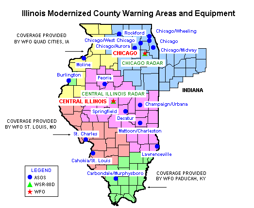
Illinois County Warning Area Map Also shows ASOS, RADAR, and WSFO locations in Illinois.
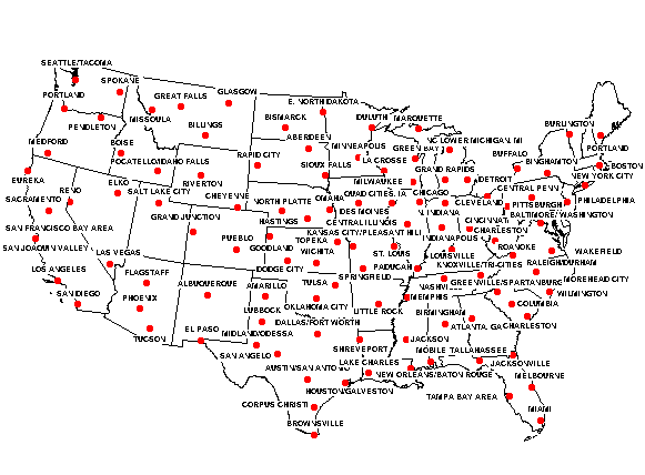
WSFO Map Showing the location of all the NWS forecast offices in the US
Forecasting Examples
Great Images of past events from SPC (latest image on top, scroll down to bottom for past images)
Splitflow Jet Example A 500mb chart with a deep, southwestern, low, in the subtropical jet stream.
Good Shortwave example
A good Lake Effect example: Flow off the lake affects the temperatures in Chicago
Very large satellite archive of Hurricane, Thunderstorm, Extrotropical Cyclones, and other images from the NWS Satellite Archive page
A great list of example images of drylines, via radar, etc from V.O.R.T.E.X.
Case Studies
Case Study Page
|

