Three types of satellite: Water
Vapor Image

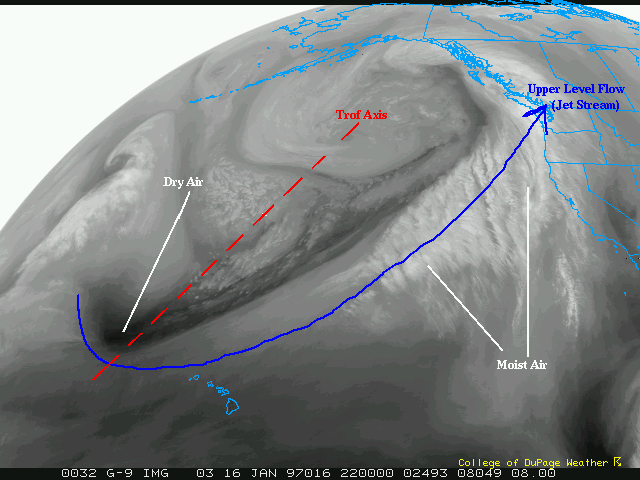
This same cyclone on water vapor imagry shows the jet stream very well.
The blackest colors, just to the north and west of Hawaii, represent dry
air. The whitest areas, off the coast of the mainland US, represent
moist air. The dry air northwest of Hawaii is the base, or southern
end, of the upper level trough. Notice how the black points northeast
and feeds into the low. This dry air is what allows it to take on it's
comma head appearance The dry intrusion. This black also shows the
southwest flow of the jet into the Pacific northwest. Notice the moisture
flow fror Hawaii to the Pacific Northwest..often referred to as the "Pineapple
Express". Areas south of Alaska, where the low is loacated, shows up as
milky white, or a bright grey. This is low level moisture pulled into the
system and most likely allowing for a low overcast. A look at visible will
give you a better idea of this.
Satellite Example Page
 The
Nexlab Home Page
 The
Nexlab Home Page
