Three different types of satellite:
Infrared Image
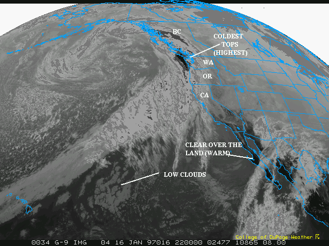
The infrared image shows the height of cloud tops by
measuring the amount of infrared radiation emitted from the
clouds. Higher tops emit less IR and are colder. The coldest
tops in this case are shown by the very dark black and dark
grey (i.e. off the coast of Washington and British Columbia).
In this satellite, which is enhanced by computer, the
black represents both the coldest and the warmest. Simply,
the black of Washington is surrounded by greys and whites and
you can infer that it is cold black. The black southeast of
the cold front (see Visibile Page for
the fronts discussion) represents warm temperatures. This
makes sense as the air ahead of the front is much warmer. The
air behind the cold front is much cooler and has a "milkier"
color as a result. Notice how the grey becomes white and
they dark grey, and then black as you look from Hawaii to
Washington. The colder tops, or brighter, represent higher
clouds and a better chance of rain.
In California, the southern area of the state has some blackness,
representing warmth. The milky whites and greys in the interior of southern
California is the cooler valleys.
Satellite Example Page
 The
Nexlab Home Page
The
Nexlab Home Page