Storm Ready®: Status Message
...loading current StormReady® status...
Current Conditions
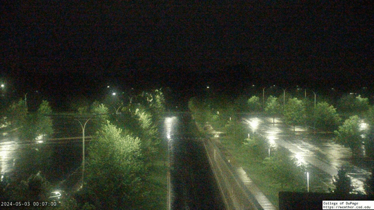
College of DuPage SkyCam
Current Local Radar
| Temperature | |
|---|---|
| 71°F | |
| Feels Like: | |
| 71°F | |
| Dew Point | Humidity |
| 55°F | 56% |
 Partly Cloudy
| Wind Strength | ||
|---|---|---|
| Light | Moderate | Strong |
| South-southwest at 9 mph | ||
Local Graphical Forecast (Updated: 03/09/26 3:46 pm)
| Monday (3/9) | |
|---|---|
| Day | Night |
 |
|
| High | Low |
| 50 | |
| Tuesday (3/10) | |
|---|---|
| Day | Night |
 |
|
|
|
|
| High | Low |
| 53 | 41 |
| Wednesday (3/11) | |
|---|---|
| Day | Night |
 |
|
|
|
|
| High | Low |
| 44 | 28 |
| Thursday (3/12) | |
|---|---|
| Day | Night |
 |
|
|
|
|
| High | Low |
| 46 | 39 |
| Friday (3/13) | |
|---|---|
| Day | Night |
 |
 |
| High | Low |
| 49 | 32 |
| Saturday (3/14) | |
|---|---|
| Day | Night |
 |
 |
|
|
|
| High | Low |
| 46 | 37 |
| Sunday (3/15) | |
|---|---|
| Day | Night |
 |
|
|
|
|
| High | Low |
| 48 | 20 |
Detailed Text Forecast (Updated: 03/09/26 3:46 pm)
Monday Night: Partly cloudy, with a low around 50. South southwest wind 5 to 10 mph, with gusts as high as 15 mph.
Tuesday: A chance of drizzle between 2pm and 5pm, then a chance of showers and thunderstorms after 5pm. Patchy fog before 11am. Otherwise, partly sunny, with a temperature falling to around 50 by 5pm. Southwest wind 5 to 10 mph becoming northeast in the morning. Winds could gust as high as 20 mph. Chance of precipitation is 30%.
Tuesday Night: A chance of showers and thunderstorms, then showers and possibly a thunderstorm after 7pm. Low around 41. East northeast wind 10 to 15 mph, with gusts as high as 20 mph. Chance of precipitation is 100%. New rainfall amounts between three quarters and one inch possible.
Wednesday: Showers and possibly a thunderstorm. High near 44. Breezy, with a northwest wind 15 to 20 mph, with gusts as high as 30 mph. Chance of precipitation is 80%.
Wednesday Night: Partly cloudy, with a low around 28. Northwest wind 5 to 15 mph, with gusts as high as 25 mph.
Thursday: Mostly sunny, with a high near 46.
Thursday Night: Showers likely, mainly after 1am. Cloudy, with a low around 39. Breezy. Chance of precipitation is 60%.
Friday: Partly sunny, with a high near 49. Breezy.
Friday Night: Mostly cloudy, with a low around 32.
Saturday: Cloudy, with a high near 46.
Saturday Night: A chance of showers. Cloudy, with a low around 37.
Sunday: Rain and snow showers. Cloudy, with a high near 48. Breezy.
Sunday Night: A chance of rain and snow showers. Mostly cloudy, with a low around 20.
Monday: Mostly cloudy, with a high near 32.
COD Weather Statistics
COD Weather Station Statistics
- Time of Observation: 3/09/26 - 5:15:57 pm
- Latitude: 41.89°N
- Longitude: -88.15°W
- Elevation: 747.63 ft
- Sunrise: 7:12am
- Sunset: 6:53pm
Current Weather Conditions
- Currently: Partly Cloudy
- Visibility: 9.83SM
- Present Weather:
- Cloud Cover: Partly Cloudy
Temperature and Pressure
- Air Temperature: 70.92°F
- Dewpoint Temperature: 54.56°F
- Wet-Bulb Temperature: 65.47°F
- Humidity: 56.24%
- Wind Chill:
- Heat Index:
- Pressure: 1004.74mb
Precipitation and Wind
- Current Precipitation: N/A
- Measured Liquid Precipitation: 0.00 Inches
- Current Wind: From the SSW at 9.39mph
- Recent Peak Wind Gust: 13.59mph at 5:15pm
Recent Station Records
- Highest Temperature (Today): 71.97°F
- Lowest Temperature (Today): 46.52°F
- Highest Relative Humidity (Today): 78.48%
- Lowest Relative Humidity (Today): 44.42%
- Highest Pressure (Today): 1008.47mb
- Lowest Pressure (Today): 1004.74mb
- Measured Liquid Precip (Today): 0.00 Inches
- Measured Liquid Precip (Month): 0.63 Inches
- Measured Liquid Precip (Year): 2.16 Inches
- Peak Wind Gust (Today): 26.74mph at 4:14pm
 790
790  217
217  558
558